Cartography
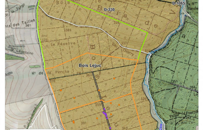
For all the following maps, we don’t know the current state of the drillings (their positions come from an ANDRA file sent to the Autorité Environementale). Some of the drillings shown here were built, but not at the position shown, other were not built, other were built but aren’t shown.
On the maps below, ANDRA laboratory is already built (and in perpetual construction), as well as the Technological Space and the Écothèque. The other works – area above the bois Lejuc, railway, “descenderie” area – haven’t been started yet.
Interactive online map
Access the map: map.bureburebure.info (you can change the language to english in the top right corner)
The Bois Lejuc
The future/old railway
This railway is supposed to be built on top of an old railway which was functional until 1975. It should go from Nançois-Tronville up to Gondrecourt, then from Gondrecourt up to the laboratory.
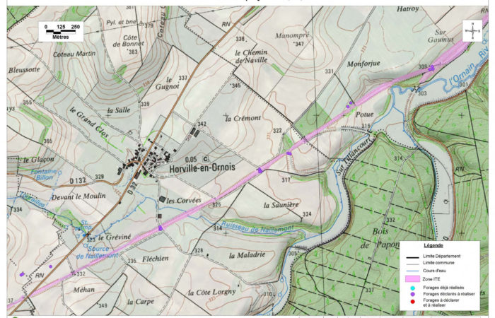
(click on the image to see a larger version) The track goes through Gondrecourt and then turns west towards the “descenderie” area of the CIGEO project
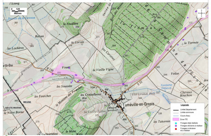
(click on the image to see a larger version) Continuing the previous image, the track should pass through the old Luméville trainstation (for the moment opponents to the project live there)
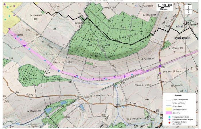
(click on the image to see a larger version) This image shows the track section that will be built across the fields (in purple) from the old railway towards the future train station of the CIGEO project (in yellow)
The “descenderie” area
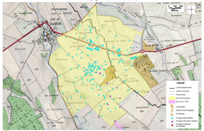
(click on the image to see a larger version) On the south of the area, a train station will be built to welcome the waste coming from the railway (in purple). This map doesn’t show the hotel restaurant and the bakery (in the not-yellow square at the north-west of the laboratory roundabout).
Under surveillance – Camera map
Participative site that lists cameras more widely internationally : sunders.uber.space
Other Maps
Map from Sortir du nucléaire of nuclear power plants, former mining sites and nuclear projects in France : Nuclear power : Permanent danger
And in french :
Greenpeace map of nuclear waste and nuclear waste routes (2019) : https://www.greenpeace.fr/carte-dechets-nucleaires/
The other maps from Sortir du nucléaire here (includes european maps).

